Proven GIS expertise
PaM brings over 42 years of combined experience in developing enterprise GIS and geospatial software for governments and partners in developing countries.
About Us
We are a GIS system provider delivering software for land digitalization, city planning, emergency response, taxation, tourism, and more.
PaM brings over 42 years of combined experience in developing enterprise GIS and geospatial software for governments and partners in developing countries.
We build integrated, cloud-enabled systems that connect desktop, mobile, and web platforms to deliver realtime geospatial intelligence.
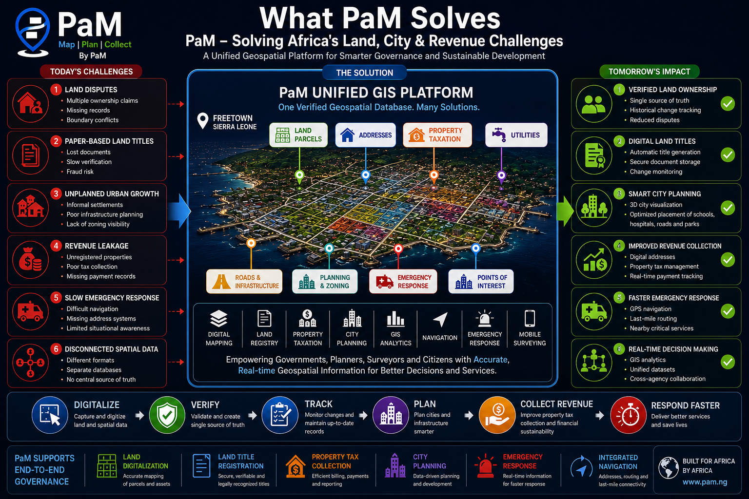
PaM’s geospatial platform is designed to address core public sector challenges through tightly integrated GIS workflows.
We are a global team of engineers and IT specialists creating geospatial applications for public sector digital transformation. Our focus is on solving the geospatial problems faced by developing countries, with solutions that support land administration, urban planning, taxation, and emergency management.
Make spatial intelligence accessible and actionable for governments, partners, and communities.
A connected public sector where decision makers use real-time geospatial data with confidence.
PaM partners with government agencies, development organisations, and infrastructure teams across Africa and beyond.