Problem Statement
Governments struggle with legacy land records, manual title registry workflows, and inconsistent parcel data.
Land Administration
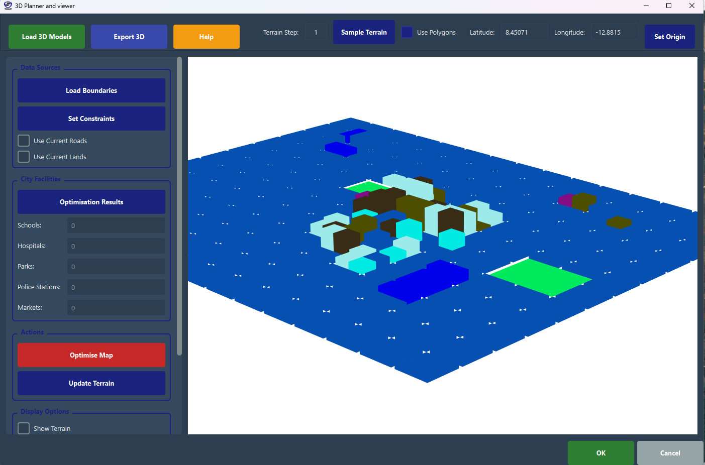
Secure digital land administration systems with cadastral workflows, title registration, and spatial governance.
Governments struggle with legacy land records, manual title registry workflows, and inconsistent parcel data.
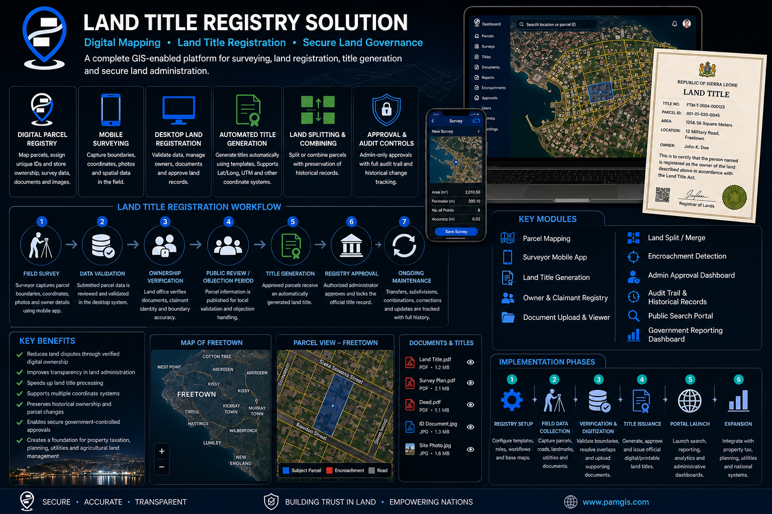
PaM delivers a secure land administration platform for record digitization, parcel management, and authoritative mapping.
An end-to-end workflow that takes a parcel from application to a registered, authoritative title.
Applicant lodges a land title request with supporting documents and ownership claims.
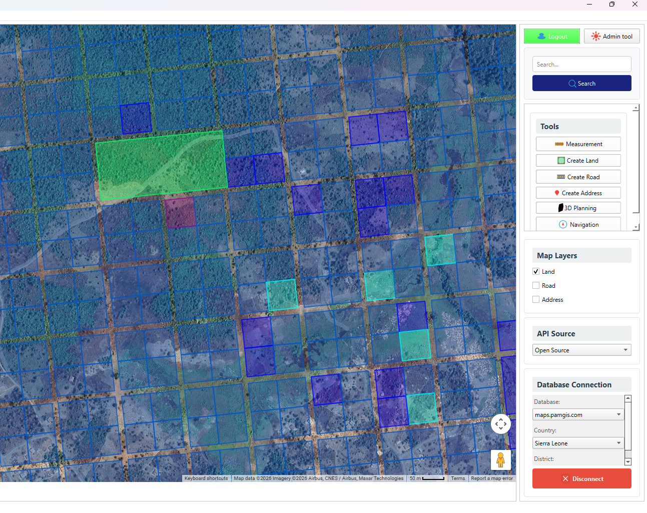
Surveyors capture parcel boundaries in the field using PaMGIS with RTCM corrections.
Quality surveyors validate boundaries and resolve overlaps, gaps, and ownership disputes.
Verified parcels are mapped into the cadastral register with unique parcel identifiers.
Records are examined against existing titles and legal requirements for compliance.
The authority approves the parcel and records it in the secure land registry.
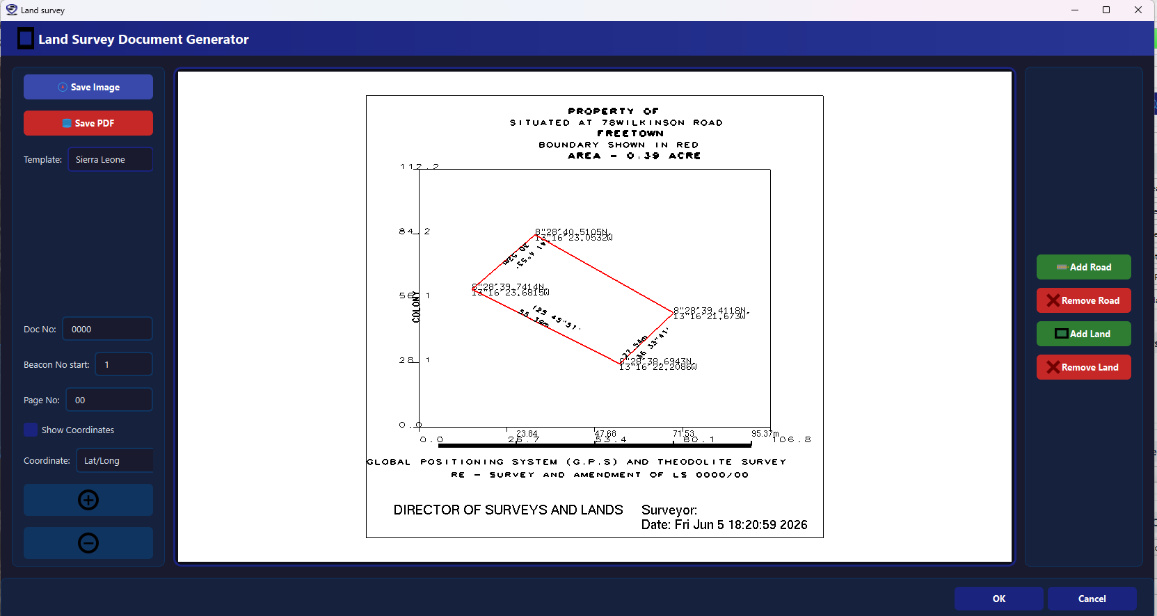
A digital title deed is generated and issued to the registered owner.
Examples of the maps, registers, and title deeds produced by the platform.