Problem Statement
Urban planners need integrated data to optimise land use, traffic, public services, and utility planning through spatial analytics and modelling.
Smart Cities
PaM enables city planners to create 3D visualisations, optimise land use, and plan infrastructure without specialist skills.
Urban planners need integrated data to optimise land use, traffic, public services, and utility planning through spatial analytics and modelling.

PaM combines spatial dashboards, scenario planning, and city operations into one digital platform, helping governments deliver smarter infrastructure and asset planning.
PaM’s city planning module extends the Smart Cities solution with 3D visualisation, terrain overlays, amenity-driven optimisation, and export-ready outputs.
Generate 3D scenes for visualisation without needing specialised planning or GIS teams. The system supports terrain, buildings, and road overlays directly in the planner.
Load planning areas from KML or spreadsheets so teams can work from field-captured boundaries, survey data, or existing GIS files.
Export 3D buildings and city models to Google Earth for stakeholder review and real-world context.
Our novel planning algorithm uses roads, land parcels and terrain data with desired amenity areas to output a complete city plan.
Designed with real city planning scenarios in mind, including rich visualisations for Freetown CBD and other Sierra Leone urban environments.
PaM supports tutorial videos and local deployment guidance to help city teams use the planner effectively.
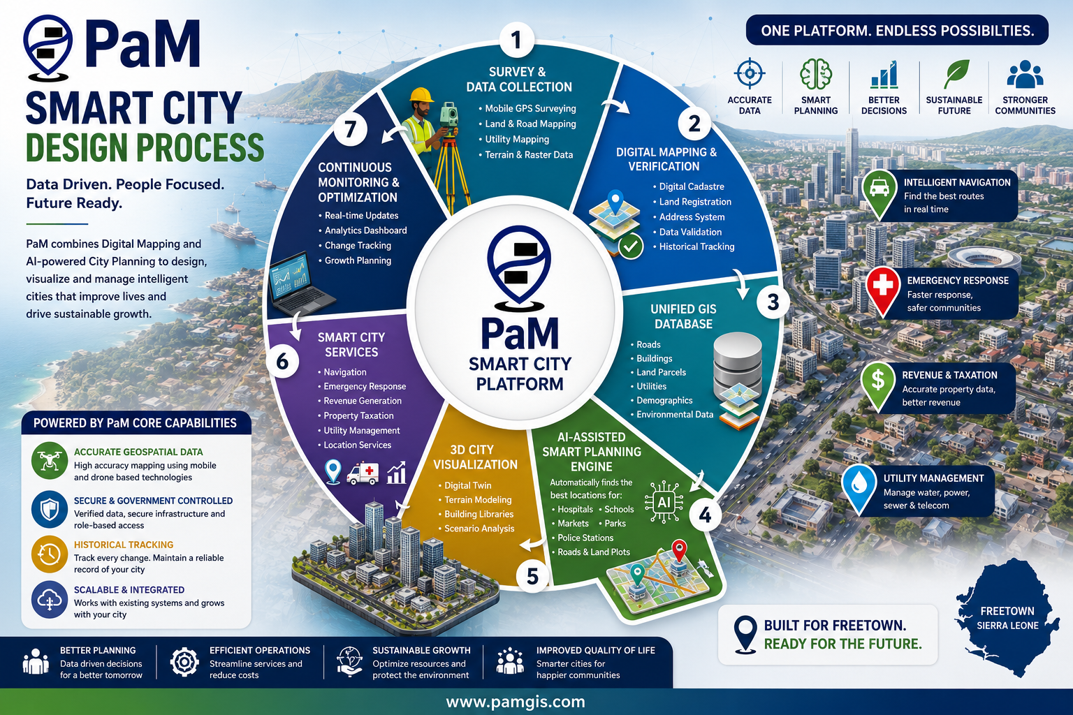
An end-to-end workflow that turns field data into a living, optimised digital city.
Capture terrain, parcels, roads, and amenities in the field using GIS-enabled survey tools.
Convert raw field data into accurate, georeferenced base maps and layers.
Consolidate every layer into a single authoritative spatial database — one source of truth.
Run the planning algorithm to optimise land use, amenities, plots, and road networks.
Generate a 3D digital twin of the city for visualisation, scenario testing, and review.
Drive smart utilities, traffic, and public services from the unified spatial model.
Continuously monitor city operations and feed insights back to refine the plan.